Map bySteve Hyde, CASP Geographic Information Specialist and Steven Wan, CASP GIS intern
by Dominic Corva, Executive Director
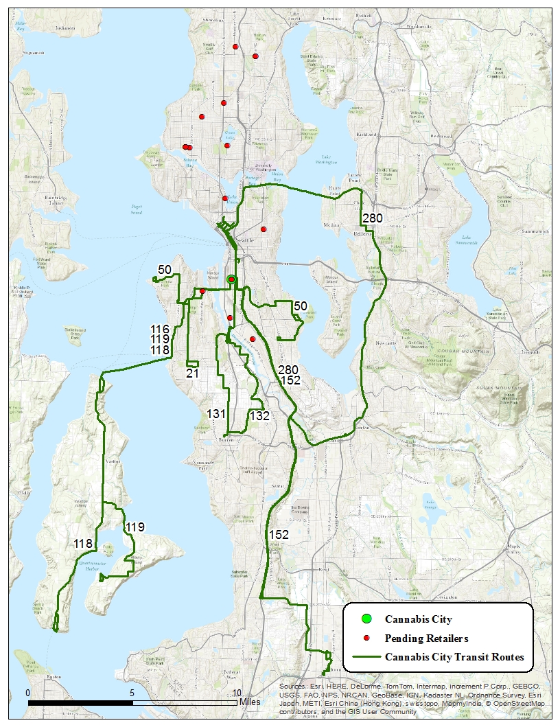
How accessible is legal retail cannabis in Seattle? This map represents our first representation of the spatial relationship between public transit bus routes and legal cannabis retailers. We begin with Seattle, but will expand to King County and other metropolitan areas as we go along. For now, the map highlights Cannabis City (which opened and then closed last week, but still) and the other 20 lottery location “winners” that may be (a) approved but not open yet (b) still in the process of approval or (c) moved somewhere else, whether through business acquisition and relocation or straightforward relocation. Given how clustered the lottery winners are, it would make a great deal of sense to locate properly zoned property in, for example, the U District.
For now, all of the bus routes that have stops within 1000 feet of “active” cannabis retailers are listed. As this landscape evolves, we will tighten our criteria and add routes near activated stores.
Special thanks to Steven Wan, our CASP GIS intern, for getting this off the ground!

